This Week in China’s History: June 1855
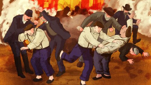
In June 1855, it rained heavily in Henan province. This was, of course, not unusual. The rain poured into the Yellow River, already swollen by seasonal flooding thanks to the snowmelt in the far-off Tibetan Plateau. On June 19, the relentless pressure overwhelmed the levee at Tongwaxiang, near Kaifeng. Within a day, a breach three miles wide released raging muddy waters onto the surrounding plain. The river deposited the silt it had accumulated as it traversed north China, burying whole villages in mud. For weeks, wave after wave of floodwaters laid waste to the area. More than 200,000 people died; seven million lost their homes.
The floods were catastrophic, but they were not unusual. The river had breached the levees several times in the decades leading up to 1855, each time leading to inundation, destruction, and death. But 1855 marked, literally, a turning point in the history of the Yellow River. When the year began, the river had flowed into the Yellow Sea, south of the Shandong Peninsula. When 1855 ended, the river emptied into the Bohai Gulf, 300 miles north!
What does it mean for the sixth-longest river in the world to change course? It’s a unique case, but imagine that the Mississippi, instead of flowing to the Gulf of Mexico at New Orleans, moved across the American south and reached the Atlantic Ocean at St. Augustine, Florida, also from one side of a peninsula to another, over a distance of about 600 miles. Historian Ruth Mostern described it in her recent book, The Yellow River: A Natural and Unnatural History: “The shift to the new course was not tidy. The river roamed across the northeast in an essentially unregulated multitude of pools and paths. It primarily occupied the channels of a Hai River tributary called the Daqing river, but it expanded to a width of almost 20 kilometers, or more than 12 miles, in some places.” David Pietz, in The Yellow River: The Problem of Water in Modern China, describes how “the Yellow River formed a vast but shallow swamp in southern Zhili province, providing an inkling of how the entire region would revert to a mosaic of lakes and marshes in the absence of human engineering.” (Pietz focuses on the era from 1855 to present, while Mostern writes mostly about the years prior to 1855.)
Flooding was nothing new on the Yellow River, China’s second-longest river. According to a 2019 report prepared for UNESCO, the river burst through its levees nearly 1,600 times between 602 BCE and 1949, including 26 major changes of course. Eight times, the river shifted between the Bohai Gulf and the Yellow Sea. The 1855 flood was monumental because of the major change in course, but it was far from the worst of the era. An 1842 flood was at least as deadly, and in 1887, Yellow River flooding killed nearly a million people in what is by some measures the worst flood in history, in terms of human fatalities.
These floods give the river its nickname, “China’s Sorrow,” but Mostern argues that this label is misleading. Mostern approaches the topic with the perspective of the “longue durée,” the method popularized by the French Annales school, and thinks in centuries and millennia rather than the human timescale of years and generations. The volatile, destructive waterway of the Ming and Qing, Mostern argues, is the product of human attempts to develop, manage, and control the river. That change began in the Song dynasty, when Chinese settlers started to develop the river’s middle reaches — Henan, Shanxi, and Shaanxi provinces — for agriculture. As grasslands and forests were cleared, and the fine loess soil of the region began eroding, flowing and blowing into the river. It was not until this period that the river became known as “yellow,” reflecting the tons of dust being carried in the water.
Flooding had gone on before the agricultural development of north China, of course, but now officials wanted to manage the river to protect the farms and homes that prospered in the rich soil previous floods had left. The river’s banks were built into levees that would keep the river from flooding. Each time the river flooded despite the levees, the levees would be built higher.
And crucially, the river was now depositing tons of silt along its course, raising the riverbed and requiring even higher levees to be built. (By 1855, the riverbed at Tongwaxiang was 30 to 40 feet higher than the surrounding plain, so when the levee breached, the river naturally flowed downhill onto the surrounding plains.) To tackle this problem, the Ming official Pān Jìxún 潘季馴 ordered the river constrained, narrowing the channel and speeding the flow and, in theory, preventing silt from falling to the bottom. This was important to Pan because his day job was as Director of the Grand Canal, which made use of the Yellow River for a distance. His concern was to control flooding, but also to minimize the dredging that all that silt was causing.
Pan’s task was public works on a mammoth scale, and he lost his job for a time because the project was deemed too disruptive, but he saw it completed in 1580. And his reasoning was sound. By some measures the plan worked, but its unintended consequences — literally, its downstream effects — were devastating. As Mostern puts it, Pan’s plan “had no solution to the accelerating quantity of sediment flowing from the Loess Plateau onto the floodplain: it simply moved it away from the Grand Canal confluence and into other locations that were of less value to the imperial regime.” Within a few decades, the increased silt in the river’s lower reaches extended the river’s mouth and enabled even more silt to be deposited as the river slowed in the wide delta. At times, silt blocked the river as it tried to empty into the sea, flooding coastal cities.
By the 19th century, as the Qing faced internal and external pressures, the overly managed river was in need of expensive, constant, and increasingly failing maintenance. Mostern writes that the cost for repairs to the levees often exceeded annual tax revenues for entire provinces. Even if the repairs could be funded, there might not be enough building material available to satisfy the enormous projects.
The Yellow River has changed course twice more since 1855. In 1938, Chiang Kai-shek’s retreating army intentionally breached the levees near the site of the 1855 rupture so that the plain would flood in hopes of slowing the Japanese advance. The resulting flood killed an estimated 890,000 people and displaced many millions.
In 1947, the breach was repaired and the river returned to its northerly course, where it remains today.
This Week in China’s History is a weekly column.